Inside Look
Part 1: How are Dirt Trails Built?
It’s a question we get often – what’s involved when building new dirt trails for hiking, trail running, or mountain biking? It’s a fascinating process and tons of fun.
Interested in getting involved? Volunteer for the Apps & Maps Team today or Come Out for a Volunteer Trail Day Saturday, August 26th.
Step #1: Vision for the New Trail
A new trail or trail network is concepted as part of the long-term planning at Truckee Trails. When envisioning new trails we partner with a variety of folks including the US Forest Service, Placer & Nevada Counties, Town of Truckee, grant makers and individual Truckee Trails donors.
We systematically look at a number of questions when analyzing a new trail:
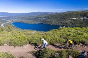
- Audience: Who is the audience – what type of trail users? Hikers, bikers, trail runners, gravel riders, etc? What is the level of difficulty? What are the accessibility requirements?
- Existing or New: Is the new trail part of an existing network or the nucleus of a completely new trail use area?
- Current Trail Use Patterns: How many and how are trail users moving around the trail network? is there a natural flow? Are there pinch points or flow interruptions? Points of overcrowding? Parking problems? Excessive erosion or wear spots?
- Role within Existing: If it is part of an existing network does the new trail connect or extend existing trails or expand the network? Does it connect the network to another network?
- Environmental Impact: Will the new trail negatively impact the local environment? Are there any known endangered species in the trail area?
- Traffic Insights: How will inbound and outbound auto traffic flow when accessing the trail? Is there sufficient parking for any additional traffic expected?
Executive Director: Insights on the Vision Step
Allison P:
“This first step is very collaborative and really fun. We’re picturing the new user experience as they discover and then regularly use a cool new trail. But, there’s a fair bit of due diligence even in this first step because the total cost of a new trail is largely determined at this stage. Yes, it’s tweaked along the way but the defined scope and scale of the trail at this stage has to fit the proposed budget.”
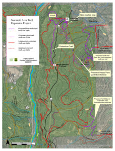
Step #2: Recon and Trail Design
Next, we walk the proposed route, often with the land owner or public land manager, and get out the mapping software (GIS solution) to design the new trail. The ‘alignment’ or recon walk is a reality check on the vision where we note necessary adjustments due to local geography and add-ons like bridges or boardwalks. Then, in the mapping software, we do a detailed route tracing of the trail incorporating desired trail features and dynamics, while considering all of the factors from Step #1 above, along with other geographic elements. We look more closely at the trail slope and gradient along the route, water flow and erosion considerations, natural vista and barrier features (ex. cliffs), opportunities to use rocks or downed trees for riding features, sight lines, intersections with roads (dirt or paved), etc.
Truckee Trails Lead Engineer: Insights on the Recon & Trail Design Step
Larry L:
“Beyond the GIS mapping software skills, this step requires an experienced trail designer who can translate the desired user experience into trail design features and vice versa. And, there are practical considerations like building sustainable trails that can hold up to winter snow, spring melt, and summer rain. All in, this is a really complex step that requires equal parts field reconnaissance, trail-building expertise, and mapping acumen. “
That’s it for now – we’ll be back next week with Part 2 of the Trail Building Series.
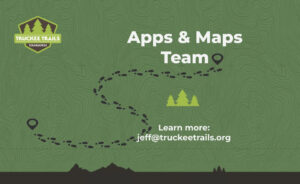
Apps & Maps Team
If you want to get involved in trail design, building and maintenance we’re looking for volunteers for our Apps & Maps project.
The Apps & Maps Team is a hands-on, all-volunteer group working closely with the Truckee Trails team using mobile GPS apps and digital maps. Together, we’re using GIS map technology to introduce the public to the trails and help them plan, navigate, and enjoy the trails more.
Volunteer roles include map design and management on the GIS software platform, working with the GPS apps like Trailforks, AllTrails, etc. (trail names & definitions, updating trail status, moderating comment streams, etc.), on-trail physical scouting and feedback (hike, bike, or run and log updates via maps), market research and survey design incorporating maps to better understand our audience and their trail needs, UX design and testing to provide maps that best meet trail user needs, and more.
Get in touch today to learn more. EMAIL US.